How to interact with other members
Comment in the AFRIS wiki
We want this CoP to be lively and innovative. Therefore, we would like to ask you for your feedback on the workshop concept and format. Please consider yourself co-organizers discussing this as a virtual group.
You can provide your feedback through inline comments on specific points (see below). General comments can be expressed at the bottom of the page.
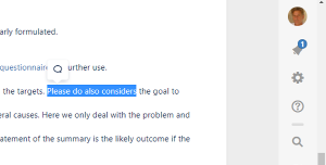
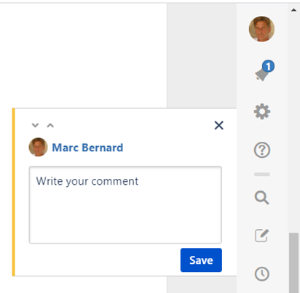
How to make an inline comment
Step 1: Highlight the text that you want to comment | Step 2: Write your comment and click on "Save" |
|
|
You can also reply to previous comments or click on like.
Use the "4 per 1000" Chat
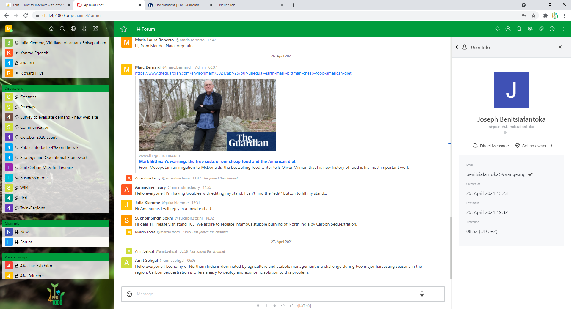
Connect to the "4 per 1000" chat at https://chat.4p1000.org. It is a easy way to communicate. It helps a lot to reduce email traffic.
You may connect with the same username and password as for connecting to the wiki, (this platform).
You need to become a member of the Community of practice to get your login. Registration is for free. Registration for the Climate-Soil Community of Practice
The Land Degradation Surveillance Framework (LDSF) is a comprehensive method for assessing soil and land health, from the field to the use of new and advanced data analytics. Land health generally refers to the degree to which the integrity of the soil, vegetation, water and air, as well as ecological processes, are balanced and sustained.The LDSF provides a consistent set of indicators and field protocols to assess the “health” of an ecosystem. This includes vegetation cover and structure, tree, shrub and grass species diversity, current and historic land use, infiltration capacity, soil characteristics and land degradation status. It can also be used as part of monitoring frameworks to detect changes over time.
This is the presentation from the session:
LDSF Webpage: http://landscapeportal.org/blog/2015/03/25/the-land-degradation-surveillance-framework-ldsf/

LDSF Flyer: https://worldagroforestry.org/output/land-degradation-surveillance-framework
LDSF Field Guide: https://worldagroforestry.org/output/land-degradation-surveillance-framework-field-guide
The LDSF was developed by the authors and colleagues over several years of land degradation research in Kenya's Lake Victoria basin, Madagascar, Mali and southern Africa. The LDSF is designed to provide a biophysical baseline at landscape level, and a monitoring and evaluation framework for assessing processes of land degradation and the effectiveness of rehabilitation measures (recovery) over time. The framework is built around a hierarchical field survey and sampling protocol using sites that are 100 km2 (10 x 10 km).
Use of the LDSF and citizen science monitoring in the Regreening Africa project:
https://regreeningafrica.org/wp-content/uploads/2019/12/LDD-Brief.pdf